The best discounts this week
Every week you can find the best discounts here.
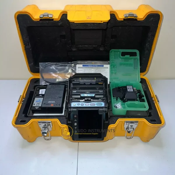
Fujikura 70S SM MM Fiber Fusion Splicer
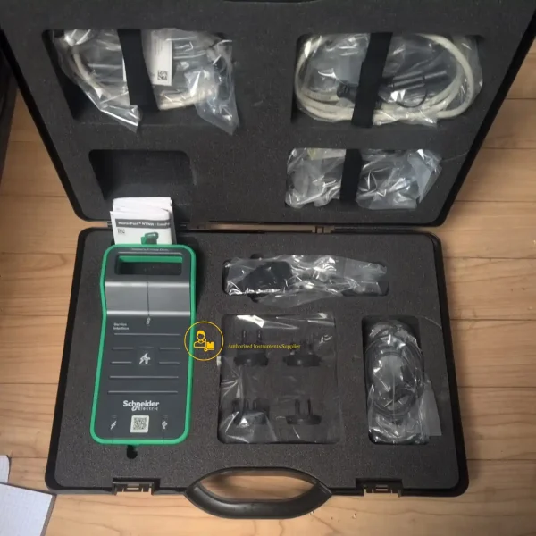
Schneider Electric LV485500 Service Interface Kit
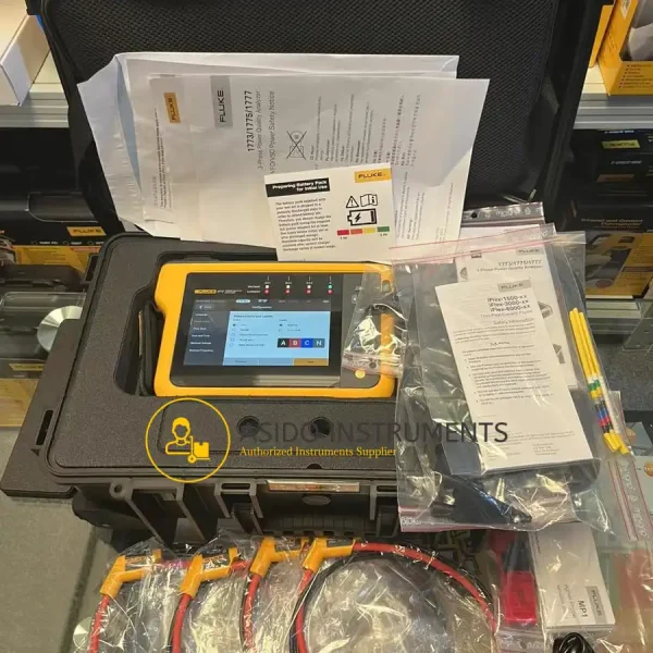
Fluke 1777 Three-Phase Power Quality Energy Analyzer
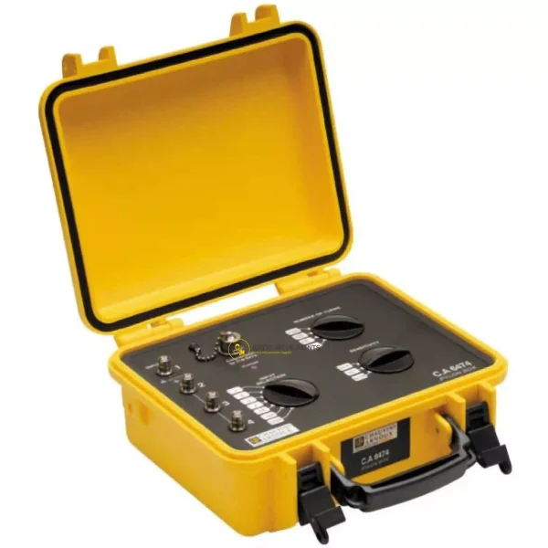
Chauvin Arnoux CA 6474
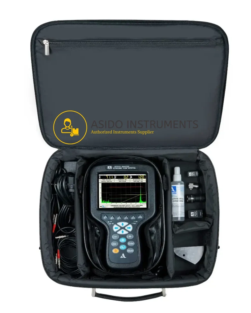
ACS Group A1212 MASTER Flaw Detector
Waygate Krautkramer Mentor UT Phased Array Flaw Detector


Trimble R1 Integrated GNSS Systems
Manufacturer: Trimble
Model: R1 Integrated GNSS Systems
Included: Trimble R1 Integrated GNSS Systems with Accessories
Description
Trimble R1 Integrated GNSS Systems is a system that connects to a phone and gives it a much more accurate GPS signal. The R1 pairs with your smartphone via Bluetooth and will act as the receiver when retrieving a GPS signal in the InfraMarker program. This dramatically improves the accuracy and consistency of your current location and makes locating and writing to tags considerably quicker.
Geomatics Land Surveying is a distributor for Trimble apparatus, so don’t hesitate to contact us should you have any questions regarding purchasing the R1 unit. Below is the step-by-step directions for utilizing the R1 and connecting it to your telephone. The Trimble R1 GNSS Receiver designed for GIS data collection and asset management.
The Trimble R1 integrates seamlessly with your iOS or Android device, allowing for much greater precision than your device by itself. Capable of supporting multiple satellite constellations, such as GPS, GLONASS, Galileo, and BeiDou, the Trimble R1 provides a global solution.
Trimble R1 Integrated GNSS Systems Features:
- Small, rugged, lightweight GNSS receiver for great mobility
- Compact, cable-free solution with integrated antenna
- Flexibility to choose your data collection device
- Bluetooth connection to Trimble handhelds or consumer-grade smart devices
- Provides higher-accuracy location data
Included:
- Trimble R1 Integrated GNSS Systems with Accessories
You may also be interested in Trimble Nomad 5 Handheld Data Collector
Specifications:
- MATERIAL AND ENVIRONMENT
- Dimensions (L x W x H): 11.2 x 6.8 x 2.6 cm
- Weight: 187 g
- Operating / Storage Temperatures: -20°C to +55°C / -30°C to +70°C
- IP65 sealing level
- Shock and vibration protection
- POWER SOURCE
- Rechargeable internal Lithium-Ion battery
- Autonomy: more than 10 hours
- COMMUNICATIONS, INTERFACES AND INDICATORS
- Bluetooth 2.1 wireless communication + EDR (10 m)
- USB 2.0 port for charging and firmware update
- SMB female connector for external antenna
- Communication LEDs (Bluetooth status, GNSS, GNSS corrected)
- Power LED indicators (charging, charged, battery status: >50% / 15-50% / <15%)
- GNSS
- L1/G1 GNSS receiver and antenna
- Systems: GPS, GLONASS, Galileo, BeiDou, QZSS
- GNSS channels: 44, parallel tracking
- Correction sources: SBAS (4 channels), CMR, RTCM, QZSS, ViewPoint RTX
- Positioning accuracy:
— Trimble ViewPoint RTX: 50 cms
— SBAS: <100 cms - Output Protocols: NMEA 0183, Binary
- SUPPORTED PLATFORMS
- iOS, Android, Windows, WEHH
Additional information
| Weight | 10 kg |
|---|---|
| Dimensions | 60 × 60 × 50 cm |
Related products


Trimble TSC5 Controller for Surveying


Trimble SPS985 with Trimble TSC3 controller and Trimble Access


Trimble Geo 7X Handheld GNSS System
Recently viewed items
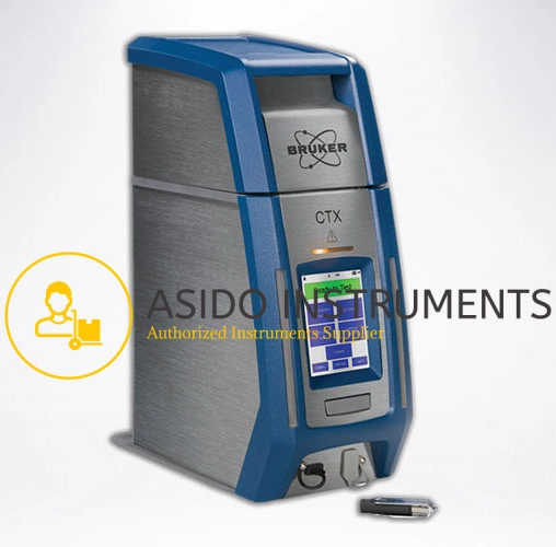
Bruker CTX 500 Portable Countertop XRF Analyzer


Reviews
There are no reviews yet.