The best discounts this week
Every week you can find the best discounts here.
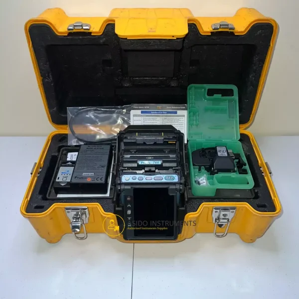
Fujikura 70S SM MM Fiber Fusion Splicer
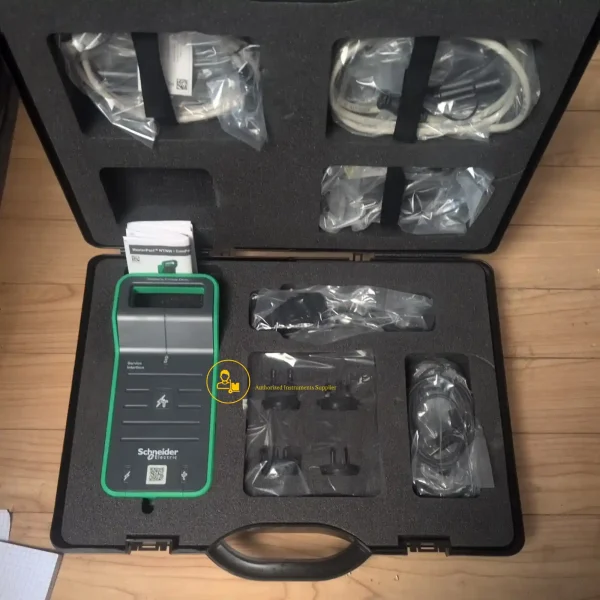
Schneider Electric LV485500 Service Interface Kit
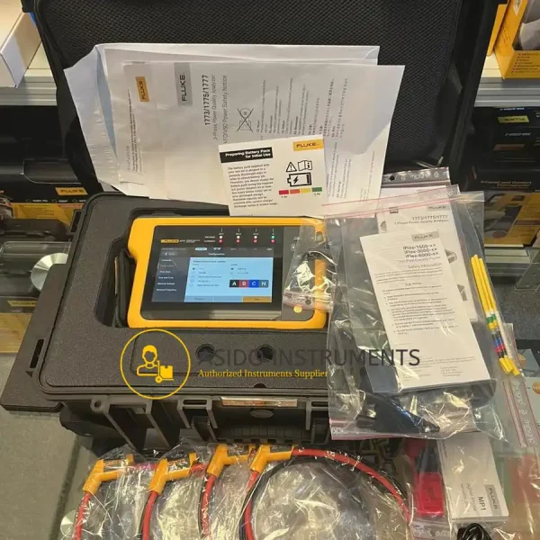
Fluke 1777 Three-Phase Power Quality Energy Analyzer
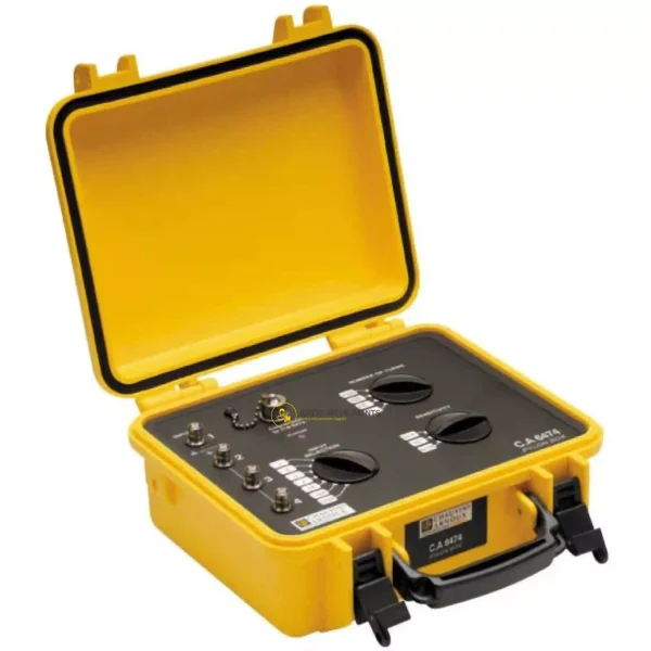
Chauvin Arnoux CA 6474
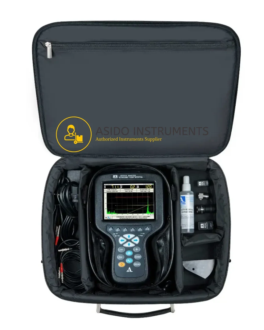
ACS Group A1212 MASTER Flaw Detector
Waygate Krautkramer Mentor UT Phased Array Flaw Detector
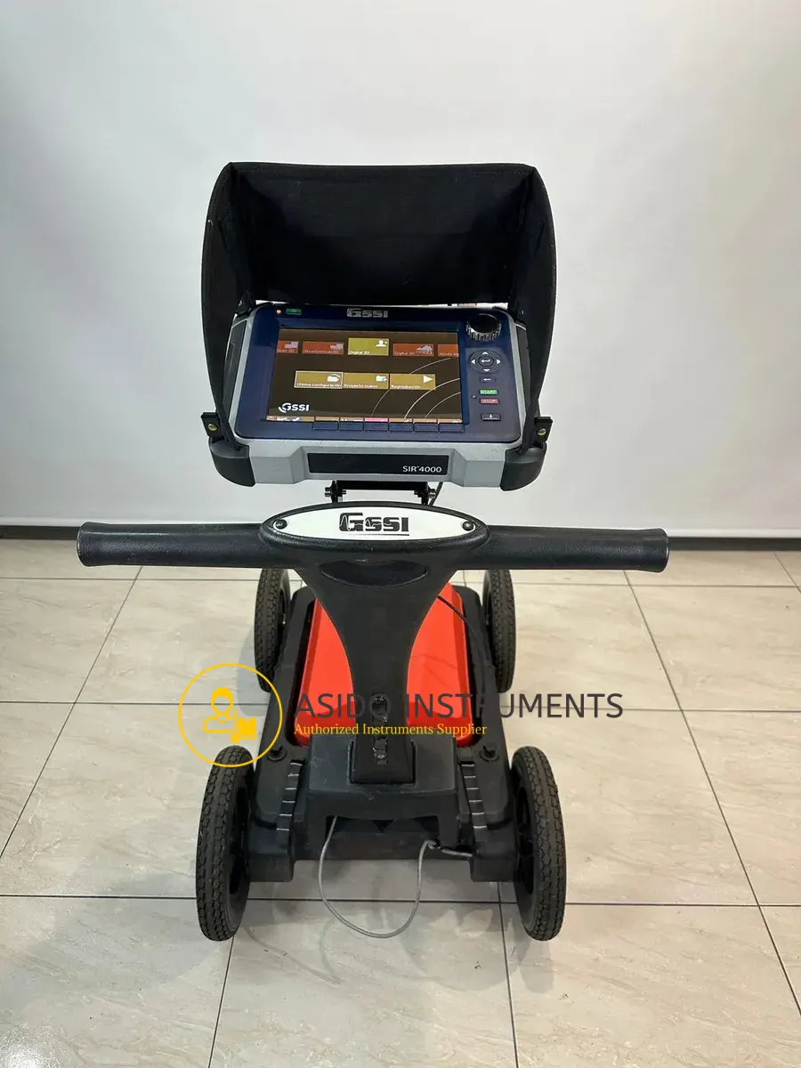
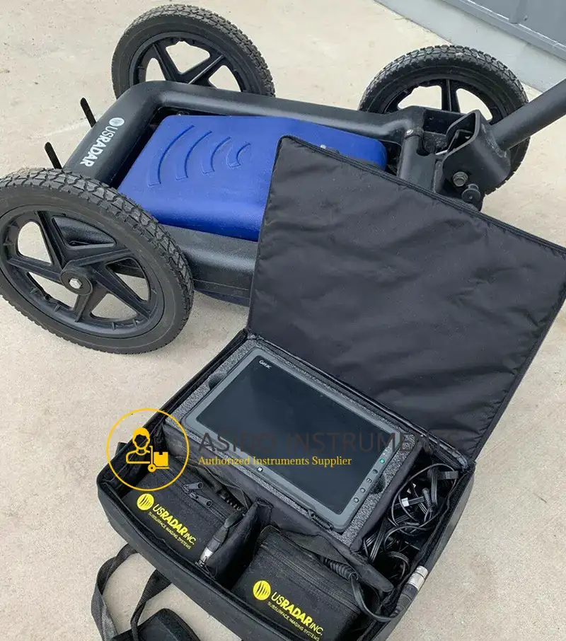
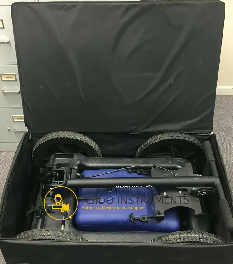
GSSI UtilityScan Pro SIR4000
Manufacturer: GSSI
Model: UtilityScan Pro SIR4000
Included: GSSI UtilityScan Pro SIR4000 with Accessories
Description
GSSI UtilityScan Pro SIR4000 is a versatile concrete inspection system offering a wide variety of antenna options for concrete and other applications. Based on the SIR 4000 controller, the StructureScan Pro provides the GPR professional with solutions to any scanning situation.
GSSI StructureScan Pro SIR 4000 Premier ground penetrating radar system for concrete inspection
StructureScan Pro is a versatile concrete inspection system offering a wide variety of antenna options for concrete and other applications. Based on the SIR 4000 controller, the StructureScan Pro provides the GPR professional with solutions to any scanning situation.
GSSI UtilityScan Pro SIR4000 Features:
- The reference in GPR data processing
- Numerous tools for editing and interpreting 2D and 3D data
- Treatments and powerful filters
- GPS positioning
- DXF, JPG, and Google Earth outputs
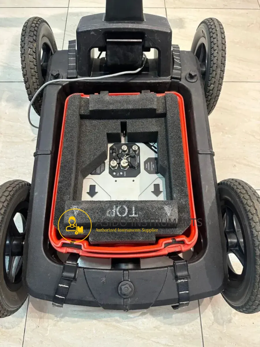
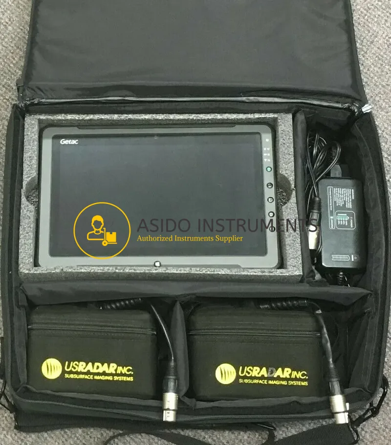
Included:
- (1X) GSSI SIR-4000 Control Unit
- (1X) GSSI 350 HS Antenna
- (1X) LineTrac utility detection accessory
- (1X) SIR 4000 sunshade
- (1X) SIR 4000 AC/DC power supply
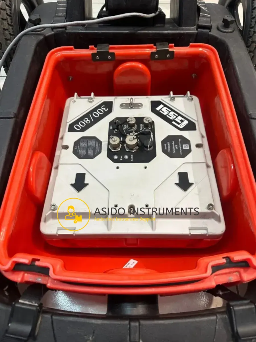
- (1X) All-terrain Forklift
- (1X) 2 m Antenna Cable
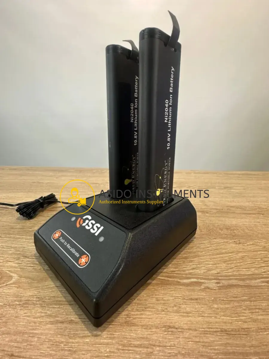
- (2X) Lithium-ion battery
- (1X) Dual-bay battery charger
- (1X) Robust transport case for SIR4000
- (1X) 4-wheel cart
- (1X) Transit case
- (1X) AC Adapter
- (1X) Sun shield
You may also be interested in GSSI 200 HS Antenna Tablet SET
Specifications:
| SYSTEM | SIR 4000 |
| ANTENNAS | Compatible with all GSSI antennas |
| NUMBER OF CHANNELS | Records data from 1 single-frequency antenna or 1 dual-frequency antenna |
| DATA STORAGE | 32 GB Flash, 1 GB RAM |
| DISPLAY | Enhanced 10.4” LED display with internal high brightness, Active matrix 1024 x 768 resolution and 32-bit color |
| GPS | Data logged internally |
| DISPLAY MODES | Linescan, Linescan plus O-scope, Wiggle trace Full 3D, 256 color bins are used to represent the amplitude and polarity of the signal |
| ENVIRONMENTAL RATING | IP65 |
| DATA ACQUISITION: | |
| DATA FORMAT | RADAN (dzt) |
| OUTPUT DATA FORMAT | 32-bit |
| SCAN INTERVAL | User-selectable, up to 4000 scans/sec |
| NUMBER OF SAMPLES PER SCAN | 256, 512, 1024, 2048, 4096, 8192, 16384 |
| OPERATING MODES | Continuous (time) or survey wheel (distance triggered) or point mode |
| TIME RANGE | 0-20,000 nanoseconds full scale, user-selectable Gain: manual adjustment from -42 to +126 dB Number of segments in gain curve is user-selectable from 1 to 8 |
| STANDARD REAL-TIME FILTERS |
|
| ADVANCED REAL-TIME FILTERS | Migration, Surface Position Tracking, Signal Noise Floor Tracking, Adaptive Background Removal |
| AUTOMATIC SYSTEM SETUPS | Storage of an unlimited number of system setup files for different survey conditions and/or antenna deployment configurations |
| AUTOMATIC ANTENNA RECOGNITION | Automatic recognition of Smart Antennas to allow maximum compliant transmit rate |
| LANGUAGES | English, Chinese, Japanese, French |
| OPERATING: | |
| OPERATING TEMPERATURE | -20°C to 40°C external (-4°F to 104°F) |
| BATTERY | Inspired Energy Ni2040ED, 3 hour runtime (battery life dependent on level of display brightness) |
| TRANSMIT RATE | Up to 800 KHz (International) US/Canada and CE rates depend on antenna model |
| INPUT/OUTPUT: | |
| AVAILABLE PORTS | Antenna inputs analog and digital (one at a time), DC power input, Serial RS232 (GPS port), Accessory connector, HDMI video output, Ethernet to PC, USB 2.0 port, mini USB |
| ETHERNET | RJ45 100BT Ethernet |
| USB HOST | USB host with external keyboard support, USB flash drive support and USB HUB support |
| MECHANICAL: | |
| DIMENSIONS | 14x10x2.75 in (36x25x7 cm) |
| WEIGHT | 10 lbs (4.53 kg) including battery |
| RELATIVE HUMIDITY | <95% non-condensing |
| STORAGE TEMPERATURE | -40°C to 60°C (-40°F to 140°F) |
| APPLICATIONS: |
|
Additional information
| Weight | 10 kg |
|---|---|
| Dimensions | 60 × 60 × 50 cm |
Related products


Hilti PS 1000B X Scan Concrete Scanner


Mala Ramac X3M GPR System


IDS Opera Duo Ground Penetrating Radar

GSSI SIR 4000 GPR Control Unit


GSSI StructureScan Mini HR GPR

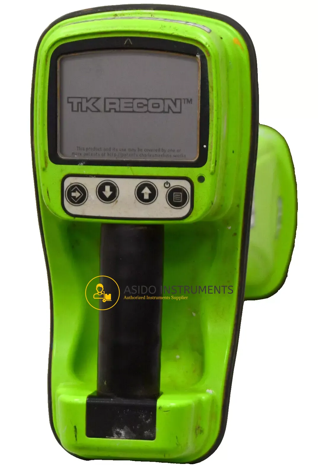
Subsite Electronics TK RECON 2 HDD Guidance System
Recently viewed items

Leica CS30 Field Controller


Radiodetection RD8200G KIT


Mala Ground Penetrating Radar

Reviews
There are no reviews yet.