The best discounts this week
Every week you can find the best discounts here.
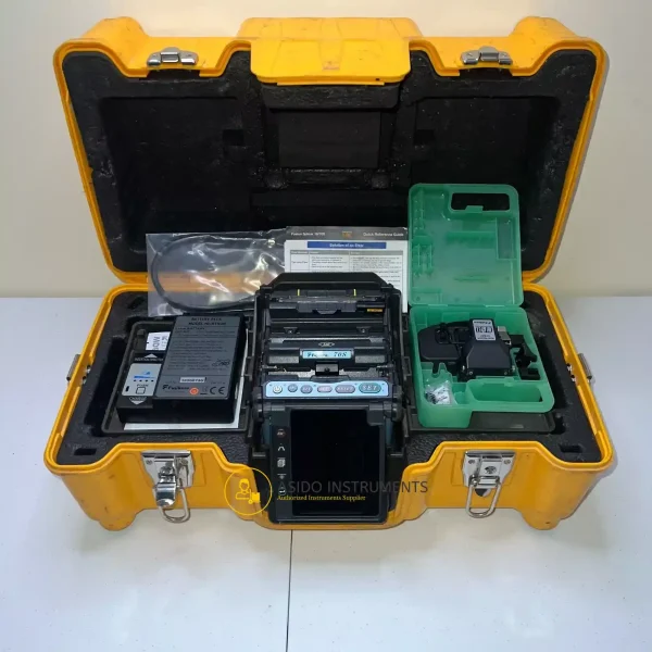
Fujikura 70S SM MM Fiber Fusion Splicer
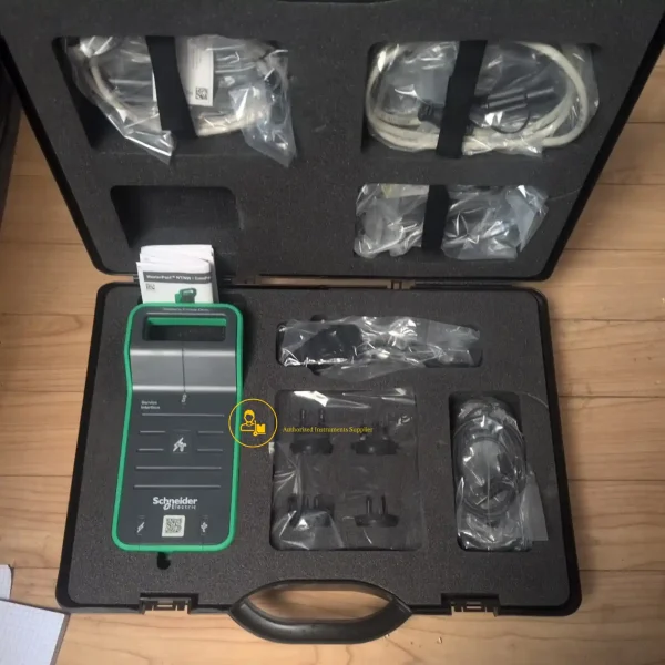
Schneider Electric LV485500 Service Interface Kit
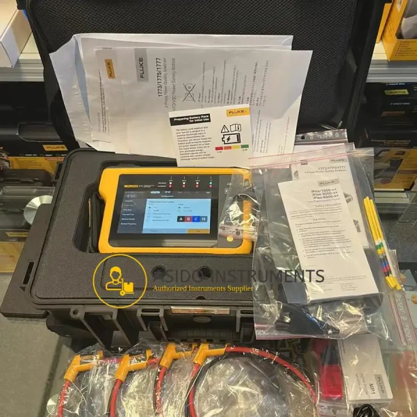
Fluke 1777 Three-Phase Power Quality Energy Analyzer
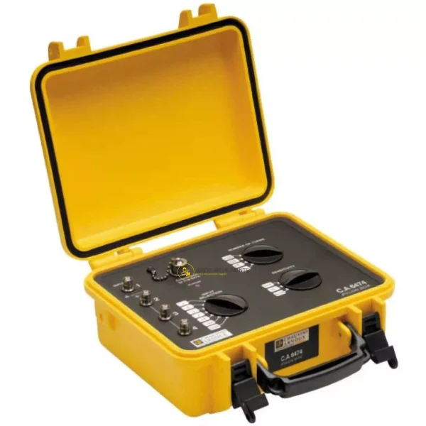
Chauvin Arnoux CA 6474
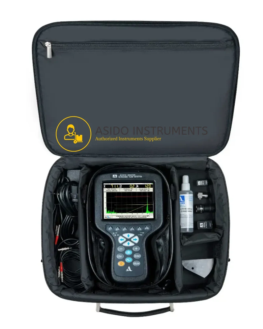
ACS Group A1212 MASTER Flaw Detector
Waygate Krautkramer Mentor UT Phased Array Flaw Detector

YellowScan Vx20 UAV LiDAR System
Manufacturer: YellowScan
Model: Vx20 UAV LiDAR System
Included: YellowScan Vx20 UAV LiDAR System with Accessories
Description
YellowScan Vx20 UAV LiDAR System is the most accurate fully integrated system from YellowScan’s product range. It can fly up to 100 m while maintaining accuracy throughout the point cloud. The Vx20 series is ideally suited for applications that require sharp and accurate descriptions.
Having a longer range and more accurate system were the prerequisites of the Vx-series. YellowScan Vx20 is the most accurate fully integrated system from YellowScan’s product range. It can fly up to 100 m while maintaining accuracy throughout the point cloud. The Vx20 series is ideally suited for applications that require sharp and accurate descriptions.
YellowScan Vx20 UAV LiDAR System Features:
- High precision point cloud
- Maximised range
- Calibrated intensify value
- Highest accuracy
Included:
- (1X) YellowScan LiDAR Solutions Vx20-100
- Yellowscan VX20 UAV Lidar
- Scanner: RIEGL miniVUX-1UAV
- GNSS-Inertial solution: Applanix APX-20 UAV
- (1X) Charger
- (2X) Lidar batteries
- (1X) GNSS antenna and cable
- (2X) USB flash drives
- (1X) Rugged pelican
- (1X) Bore sight calibration certificate
- (1X) Documentation
You may also be interested in ImpulseRadar PinPointR GPR Utility Locator
Specifications:
- Precision 1cm
- Accuracy 2.5cm
- Echoes per shot Up to 5
- Laser wavelength 905nm
- GNSS-Inertial solution Applanix APX-20UAV
- Weight 2.84kg (6.25 lbs) battery included
- Size L35 x W11 x H17
- Autonomy 1.5 hours typ.
- Power consumption 25W
- Operating temperature -20 to +40°C
Additional information
| Weight | 10 kg |
|---|---|
| Dimensions | 60 × 60 × 50 cm |
Related products


RIEGL miniVUX 1UAV Lidar Sensor

Trimble TCU5 Field Controller Unit


Trimble Yuma 2 Rugged Tablet Computer


Trimble TSC5 Controller for Surveying


Reviews
There are no reviews yet.